-
الأبحاث
-
الأبحاثيقوم المركز بإجراء وتيسير الأبحاث العلمية المبتكرة والمتعدّدة التخصّصات، وينشرها بأشكال مختلفة. يتمّ إعداد الأبحاث وإجراؤها بواسطة شبكة الخبراء والزملاء الذين يتعاون معهم المركز، بهدف تعزيز فهم المواضيع التي يتناولها المركز، بالإضافة إلى إثراء النقاش العام والسياسات العامّة.
-
-
-
عمليات المسح ورسوم بيانية
-
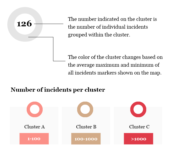
عمليات المسح ورسوم بيانيةيطوّر فريق المركز عمليات مسح استنادًا إلى تصنيفات يطّورها، بالإضافة إلى الرسوم البيانيّة وأدوات أخرى للتصوير المرئي للمعلومات. قد تعتمد هذه العمليات على البيانات الكمّية والنوعية، وتهدف إلى تقديم أفكار إضافية واستكمال التحليل النوعي الذي يُجريه المركز. يشمل ذلك: الخرائط الجغرافية التفاعلية، والمخطّطات البيانية، والجداول الزمنية، بالإضافة إلى تصوير البيانات والرسوم البيانية بناءً على اتّجاهات البيانات ونتائج الأبحاث.
-
-
-
المواضيع
-
المواضيعأبحاثنا منظّمة تحت عدّة محاور مواضعية من أجل تسهيل تصفّح الموقع للقارئين/ات. تندرج المنشورات التي تعالج أكثر من موضوع تحت كلّ المواضيع ذات الصلة.
-
-
- مجلّة المجتمع المدني
-
الدعوات والإعلانات
-
الدعوات والإعلاناتينشر المركز دعوات لتقديم المساهمات وللزمالات بشكلٍ منتظم. تضمّ هذه الصفحة الدعوات بالإضافة إلى النشرات البريدية ومخرجات الندوات.
-
-


